Tentang KamiPedoman Media SiberKetentuan & Kebijakan PrivasiPanduan KomunitasPeringkat PenulisCara Menulis di kumparanInformasi Kerja SamaBantuanIklanKarir
2025 © PT Dynamo Media Network
Version 1.103.0
Konten dari Pengguna
The Beautiful Raja Ampat and Its Geographical Position
22 Desember 2021 13:54 WIB
·
waktu baca 4 menitTulisan dari Michael Manufandu tidak mewakili pandangan dari redaksi kumparan

ADVERTISEMENT
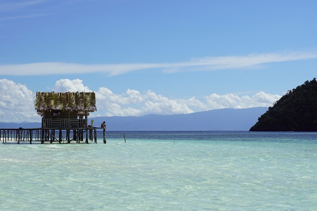
Straddling the equator and comprising part of the coral triangle, Raja Ampat archipelago in Raja Ampat regency has the richest marine biodiversity on the planet. It is very famous for its diving sites and breath-taking views on land and underwater. It is understandable why this place is on the bucket list of many people.
ADVERTISEMENT
Raja Ampat Regency Geographic Position
Raja Ampat regency is one of the districts in West Papua. The capital city of this regency is in Waisai. This district has 610 islands, including the archipelago of Raja Ampat as mentioned above.
There are four main islands in this archipelago; they are Misool Island, Salawati Island, Batanta Island, and Waigeo Island. From all of the islands in Raja Ampat, only 35 islands are inhabited, while the rest are unpopulated and some even have no name yet. At the moment, it has 7,559.60 km² of land area, 59,820.01 km² of sea area, as the total area is 67,379.61 km².
Most regions in Raja Ampat regency consist of an archipelago in the position of latitude 0° 13' 60.00" N and longitude 130° 30' 59.99" E. The four main islands of Raja Ampat are non-volcanic islands. But, they are hilly and mostly covered by the dense rainforest. The scattered smaller islands are karsts and non-volcanic islands which are overgrown by coconut trees and bushes.
ADVERTISEMENT
Raja Ampat borderlines are Pacific Ocean on the North, Sorong City and Sorong Regency on the East, Seram Sea is on the South borderline, and for the West borderline there are Seram Sea, Central Halmahera and North Maluku.
Raja Ampat Topography
Raja Ampat regency as an archipelago has limited land area and mostly its topography is dominated by hills which are covered by forests. The coastline has various characteristics such as sloping black sand beach, sloping white sand beach along with broken coral and the virgin coral, deep sea, and also mangrove. In Waigeo island, there is Mount Nokh, with a height of 715 meters above sea level.
Most of the area is steep slopes like Batanta Island, Waigeo Island, and Salawati Island. These mountain areas could be 100 – 300 meters above the sea level. Based on its physiography, north of Raja Ampat regency, which is Waigeo Island and half of Batanta Island are dominated by mountains. In the center, Salawati Island has quite a wide dry land area. Misool Island, even if half of the coverage is mountain, in the center of the island is plateau.
ADVERTISEMENT
Geology and Hydrology
Geology condition of the Raja Ampat regency is dominated by limestone and they were formed during the quarter era. Its soil is composed of dabas stone, neogene and limestone. Together, they formed small hills. In general, those limestones are solid and contain sands like facet limestone, daram, atkari, zaag, openta, sagewin, and bogal. The main source of limestone is from sea creatures.
Some big rivers can be found in Waigeo island. They are Bayon River with length around 4km and Kamtabai River. In West of Misool there is Kasim River. Based on the groundwater potential, most of dryland area in Raja Ampat regency don’t have fresh groundwater, unless in big islands like Waigeo, Salawati and Misool.
ADVERTISEMENT
Climate
Raja Ampat regency’s climate is tropical rainforest, with high rainfall intensity throughout the year. Maximum rainfall in this region is starting from May-July, with monthly rainfall more than 220mm per month. Temperature is around 22°–33 °C.
Conclusion
Raja Ampat regency in West Papua consists of Raja Ampat archipelago. The main islands have fresh groundwater, while the small islands are not. They are covered with rainforest. Even if it has many islands, only several are inhabited.

