
Addressing Future Global Challenges Through Strengthening Spatial Literacy

Remote Sensing and GIS Enthusiast
·waktu baca 3 menit
Tulisan dari Yusuf Susena tidak mewakili pandangan dari redaksi kumparan
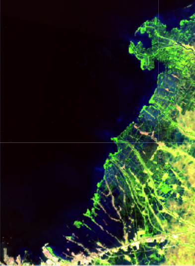
In the rapidly evolving digital era, spatial literacy has become one of the key competencies in achieving the Indonesia Maju (Advanced Indonesia) vision. However, spatial literacy remains a relatively unfamiliar topic among the general public in Indonesia. Spatial literacy refers to the ability to understand, analyze, and utilize geospatial information in decision-making, whether at the individual, community, or governmental level.
Why Is Spatial Literacy Important?
Supporting Sustainable Development Planning
Spatial literacy enables better spatial planning, preventing land conflicts, and ensuring sustainable development. Through the use of GIS technology and remote sensing, the government can optimize land use for infrastructure, agriculture, and environmental conservation.
Disaster Mitigation and Climate Change Adaptation
Indonesia is highly vulnerable to natural disasters such as floods, volcanic eruptions, landslides, and earthquakes. Spatial literacy helps in mapping disaster-prone areas, designing mitigation strategies, and enhancing community preparedness against the impacts of climate change.
Optimizing Natural Resources and Agriculture
Understanding land use patterns and environmental conditions allows for more effective management of the agriculture and forestry sectors. The use of satellite imagery and geospatial data can improve precision farming efficiency, reduce land degradation, and support national food security.
Developing Smart Cities and Digital Infrastructure
The smart city concept requires the integration of spatial data to support intelligent transportation, energy management, and digital-based public services. With strong spatial literacy, urban management can become more efficient, enhancing the quality of life for citizens.
Enhancing Indonesia’s Human Resource Competitiveness
In the future, geospatial technology expertise will become increasingly valuable across various sectors, including industry, mining, and the creative economy. Therefore, strengthening spatial literacy in the education curriculum will help develop highly skilled human resources capable of competing globally
Strategic Steps to Improve Spatial Literacy
Integrating Geospatial Education into the Curriculum:
Improving spatial literacy from an early age through formal education and digital skill training in GIS and remote sensing is essential. Currently, spatial literacy aspects have been introduced into several subjects at primary and secondary education levels, which is a wise step that needs to be expanded. Making spatial literacy a specialized thematic subject would be a significant advancement, as some developed countries have already implemented this.
- The United States integrates spatial literacy concepts into STEM and Geography subjects.
- The United Kingdom’s National Curriculum for Geography explicitly includes mapping skills, spatial analysis, and GIS technology usage from elementary to middle school. Many other countries have also adopted similar approaches.
Strengthening Policies and Regulations:
Encouraging policies that promote open access to spatial data and broader access to geospatial technology.
Collaboration with the Private Sector and Academia:
Building synergy between the government, academic institutions, and industries to foster innovation based on spatial data.
Empowering Communities through Digital Literacy:
Raising awareness and enhancing public skills in utilizing spatial technology for social welfare and inclusive development.
With strong spatial literacy, Indonesia can maximize its resource potential, improve development efficiency, and better tackle global challenges. Strengthening spatial literacy is a crucial step toward realizing a sovereign, independent, and globally competitive Indonesia in the future.